


MM
-
Content Count
2,191 -
Donations
$75.00 -
Joined
-
Last visited
Recent Profile Visitors
9,361 profile views


-
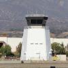
Dominican Diagonal For Saturday, April 20, 2024 Today we shall take a look at part of the Dominican Republic. Starting with an aerial tour of Santo Domingo, we shall fly northwest over the Cordillera Central to the Haitian border. We take a quick look at the sights of the Cap-Haïtien area and then return along the northern coast of the Dominican to Puerto Plata and south to Santiago, the country’s “second city.” High over the Cordillera Central We begin at Santo Domingo’s Las Américas [MDSD], located just southeast of the capital city. This airport is the country’s second-busiest (after the tourist-oriented Punta Cana) and the country’s and the Caribbean’s busiest cargo hub. After departure we circle sharply over the east to see the numerous newish Baseball Academies sponsored by US Major League teams and by local entrepreneurs and scouts, the buscones, who recruit and train young Dominicans for a potential professional career. While a tough uncertain business, for many teenagers this is a way out of poverty and a chance to earn millions. For the country, this is a lucrative export industry (that returns hundreds of millions to the national economy). For the population, this is a manifestation of the national sporting identity. In 2023, 11 percent of Major League players were Dominicans! We turn back to Santo Domingo itself which, at about 4 million, is the largest metropolitan area in the Caribbean and comprises about a third of the country’s population. It is the nation’s political, economic, financial, and cultural center. And while it includes some very poor neighborhoods, it has a large prosperous middle class. Dating from 1493, Santo Domingo is the hemisphere’s oldest European city. Our first point-of-interest is the Faro a Colón (Columbus Light) which was completed in 1992 to commemorate the 500th anniversary of Christopher Columbus’ “Discovery of the Americas.” This large facility can produce a light-show visible from as far away as Puerto Rico. We cross the Ozama River to the Colonial District (la Ciudad Colonial), a UNESCO World Heritage Site, with its 16th century buildings, palatial houses, majestic churches and splendid museums – as well as night life and trendy restaurants. The Church and Convent of los Dominicos is the oldest Catholic structure and the site of the first university in the Americas. (Just to the north is the modeled San Francisco Monastery, the hemisphere’s oldest.) Turn Northwest to pass the grand National Palace (the Presidency’s offices). And then swing around the Olympic center with good models of its Olympic Stadium and indoor Sports Palace. Further on is the new Mormon Temple. And go down to the coastal Avenida George Washington at the high rise Malecón Center. (This modern coastal promenade is home to shops, casinos, theaters, and luxury apartments and hotels.) We fly to the Supreme Court (modeled) and National Congress (not-modeled). And westward, passing the Torre Caney (tallest in the Caribbean) to the Plaza de la Bandera, a 20th-century-built national public square around which are sited government ministries, including the headquarters for the Defense Ministry. The Plaza hosts patriotic events and other occasions. (Pope John Paul spoke here; over the years, some anti-government demonstrations have gathered here.) We turn north to land at La Isabela International [MDJB] (also El Higero or Dr. Joaquin Balaguer) which serves as a hub for scheduled and charter flights to destinations in the D.R. and on other Caribbean islands. It the base for small Dominican carriers and general aviation. We depart to the northwest climbing into the Cordillera Central (the highest mountain range on Hispaniola) to Constanza [MDCZ]. The mountain town may be the coolest settlement in the Caribbean. But it has no freezing temperatures – which are common in the nearby and higher Valle Nuevo National Park. (In 1959 Fidel Castro airlifted 40 Cuban-trained rebels into Constanza to kill the brutal dictator Rafael Trujillo and start a Communist revolution. It took two months of mountain warfare for the Dominican army to prevail. Two years later, Trujillo was assassinated by the Dominican opposition.) We take off to climb over the rising mountains to pass Pico Duarte (at 3,101 meters, 10,174 ft, the highest peak in the Caribbean) and near its twin Loma La Pelona (at 3,097 meters). We land at the long grass strip at Dajabon [MDDJ]. This has been a military field and is now shared with private pilots (who use the strip as an interesting destination). From here we take a little excursion into Haiti. This could be a little dangerous due to the armed violence now raging in the country. In the late eighteenth century, while the French Revolution was under way, the French colony’s enslaved and free people of color launched their own revolution and eventually defeated Napoleon’s troops in 1804. This was the first, and only, country established by a successful slave revolt. The third general of the revolutionary army made himself Henri I of the Kingdom of Haiti and (using forced labor) built a grand palace Sans-Souci that gathered international attention for its extravagantly beautiful design. In 1842 it was destroyed by an earthquake and was never rebuilt. Flying overhead, we can see the extensive ruins. (Take care: the palace is located in a dead-end canyon.) Henri Christophe also built the Citadelle Laferrière about 3 miles southwest – again using forced labor (perhaps costing up to 20,000 lives). This 3,000 foot-high mountaintop fortress, armed with 365 cannons, was the key to the planned defenses against a potential French incursion. The palace and citadel have since become symbols of national independence and are UNESCO World Heritage sites. Both, but especially the fortress, are worth a closer look. We turn to the north a few miles and land at Cap-Haïtien [MTCH]. Due to the current security situation, flights from Cap-Haïtien to the US have been suspended – although the airport remains open. We have been asked to make a special pickup at the terminal building and continue on with our tourist flight. This is voluntary. If you do choose to land at the terminal at the north end of the runway, please keep your engine running so as to expedite an extremely fast turnaround. If we have the time, we shall take a look at Notre Dame of Cap-Haïtien Cathedral (1670) on whose steps slavery was declared abolished in 1793. Flying east, we cross the border to land at Monte Cristi [MDMC]. Continuing along the northern Atlantic coast we pass over La Isabela. This was the site of the first stable Spanish settlement in the Americas in 1493 – though it was abandoned seven years later after Columbus chose what is now Santo Domingo as his new city. This is now an historic park and museum. We fly further along the beautiful coastline to Puerto Plata, the main commercial port city and now tourism center along the northern coast. A point of interest here is the Teleferico de Puerto Plata, a cable car that runs up to 3,500 ft to the top of Pico Isabel de Torres which provides a great view of the city below. As we turn toward the east we can see the fine beaches that are now a tourist magnet. We land at Puerto Plata Gregorio Luperón [MDPP]. This is a busy international airport with scheduled flights to major cities in North America and Europe. A handy spot for our special passengers ... if there were any special passengers. Finally, we turn south over the mountains to Santiago de los Caballeros, the second-largest city in the Dominican Republic (and the sixth-largest in the Caribbean). It is located in the large fertile Cibao Valley, the country’s main agricultural region, and the city has become a major cultural, industrial, and financial center. The city has one of the highest incomes per capita and a large middle-class population. Historically it has been a political-economic counterweight to the larger Santo Domingo. (A symbolic example: over the last 70 years the country’s dominant baseball team has been Licey of Santo Domingo. The second best team has consistently been Aguilas Cibaeñas of Santiago.) As we fly over the city, we see the Monumento a los Héroes de la Restauración which salutes those who fought in the bloody Restoration War of 1863 to regain independence from Spain. The center for that fight against Spain was Santiago – not Santo Domingo. If we have plenty of time, we can divert our approach to include seeing the Iglesia Sagrado Corazon in Moca just east of the airport. It is a pretty colonial-era church whose glass windows, depicting the crucifixion, were originally brought from Italy. Our final destination is Santiago Cibao International [MDST], 9 miles southeast of Santiago’s city center. Opened in 2002, this is the nation’s third busiest airport. It serves as a domestic center as well as an international connection to the United States and Puerto Rico. Since 2008, the airport has eliminated fees for private planes – to encourage regional tourism. Why not accept that offer? Documentation The flightplan can be found here. Aircraft This is a (mostly) tourist flight of about 320nm. You want something that will “fast cruise” at 160-165kts (including among others the Comanche, Bonanza, Caravan, Mooney, and light twins). I shall choose the Black Square Bonanza. You should, of course, fly what you like. Additional Scenery All the airports and most of the POIs are in the default simulator. A few of the POIs are in the addons below. And several of the addon airports will enhance the scenery appreciably. Thanks to the talented addon creators. Santo Domingo Las Americas [MDSD]. lcristea Dajabon [MDDJ]. davidabelr1 Cap-Haitien [MTCH]. Mountainair Santiago Cibao [MDST]. lcristea Santo Domingo Landmarks. KingJ02 Temporarily, you can obtain the package here (29MB). (If you have the Mamudesign Project Lifts, you might want to activate it.) Time and Weather For takeoff on Saturday, set the simulator at 2:00pm local for April 20, 2024. We typically prefer real weather and will follow form if the weather is good. If not, I recommend the ”High Clouds” preset. Multiplayer Particulars Date and time: Saturday, April 20, 2024. 1800 UTC RTWR Multiplayer Discord Channel Microsoft Flight Simulator Multiplayer: United States East server. If you want to help others enjoy the multiplayer experience, don't forget to enter your aircraft details on the multiplayer spreadsheet (linked here). Please be kind enough to enter the title exactly as it stands in the title=”xxx” line of the aircraft.cfg file. Your courtesy will save others a lot of time and effort. Thanks!
-
Nifty idea Bert. Lots of fun to think back to the grandly optimistic Bruce Artwick Sublogic days. And of course to reflect on the spectacular progress that the MSFS-Aces and MSFS-Asobo teams (and the many independent developers) have made. Thanks! First, here are three modest-but-helpful airport enhancements: Chicago Midway [KMDW]. kingnothing75 (Adnan Arif). I previously used this addon and can report that it is a fine freeware. I haven’t tested it since getting the DD payware, but the current user commentary remains positive. Kankakee [KIKK]. rafaelhgk Central Illinois Regional Bloomington-Normal [KBMI]. pilotguy121a A small package is temporarily available here. Second, a note for those using Drzewiecki Design Chicago Landmarks. The published mission setup will work well – the setup does without the DD Landmarks. However if you want to use the DD Landmarks, then a problem may arise with the Landmarks package clobbering the Microsoft handcrafted Meigs Field. (The runway will be usable, but the airport is mashed potatoes.) On November 11, 2022, Bert suggested a work-around. Currently, Drzewiecki has no automated fix and urges uses who want to use both Meigs and DD Chicago Landmarks to find a way to make Meigs the higher priority scenery entry. Bert’s suggestion should work for many people. With my setup, I had to do something more complicated: (a) Use 7zip to compress a copy of microsoft-airport-kcgx-meigs-field in the Official folder and copy the zipped scenery folder to one side and keep the copy. Then (b) use the MSFS2020 Content Manager to officially delete microsoft-airport-kcgx-meigs-field official entry. (This deletion can be reversed later if desired. The advantage is that once “officially deleted” MSFS won’t try to update the scenery if it discovers the file missing.) Then (c) unzip the microsoft-airport-kcgx-meigs-field that was previously zipped up and saved and place it in an appropriate location. (d) Rename the airport folder something like “ZZZ_microsoft-airport-kcgx-meigs-field” which, by its new alphabetic rank, now has higher priority than the DD Chicago Landmarks folder. And finally (e) activate the renamed folder using the Addons-Linker. (The longer multi-step procedure comes from the simple “move and activate” process not working. It may be just fine for you. My problem was that when I simply moved the microsoft-airport-kcgx-meigs-field folder, then a subsequent reload of the simulator discovered the need for an immediate 6.5 GB update. Happily I could reinsert the original microsoft-airport-kcgx-meigs-field folder into the Official folder and the simulator then found no need for a huge update. You may not have this problem, but might well keep a copy of the zipped scenery folder just in case.)
-
@John Dowson Thanks for your working on this. I did do a "manual" tweak to 200 seconds. (Old machine. Lots of installed aircraft and scenery.) Will do some experimentation and get back. All your work is much appreciated. (And best wishes to your father!)
-
Press any key to start - loop
MM replied to Espana Pete's topic in Microsoft Flight Simulator (2020)
See also: Push Any Button Loop Workaround. twotonemurphy. 03-21-24 -
How can I stop the DHC2 Beaver from creeping forward?
MM replied to Jarnie's topic in Microsoft Flight Simulator (2020)
One workaround is to use Toolbar Pushback by AmbitiousPilots. (You activate the pushback with a tug speed of zero.) This seems to be an imperfect solution. Perhaps others have better ideas. -
British Columbia’s Coastal Wilderness
MM replied to MM's topic in AVSIM's Round the World Race Forum
Note to those with too much time on their hands. For more on the Eagle Show (along with a little local context) see EPIC Bald Eagle feeding frenzy in British Columbia, Canada. -
Press any key to start - loop
MM replied to Espana Pete's topic in Microsoft Flight Simulator (2020)
Yup. It's the "in" thing nowadays. The Gaming Services "reset" sequence seems as effective as any. Thanks for working this out. -
Press any key to start - loop
MM replied to Espana Pete's topic in Microsoft Flight Simulator (2020)
Thanks Ron. M -
John, Would it be possible to write a subroutine for FSUIPC that would (when asked) time the response and make a recommendation? Or better yet, (when asked) to generate an entry for the ini file that would set the parameters appropriately. Gosh, my eyes glazed over when thinking through how to do this manually. And then do it again to suit further developments. Thanks, Mike
-
British Columbia’s Coastal Wilderness The Islands of Johnstone Strait and Discovery Passage For Wednesday, April 3, 2024 Today we shall take a tour of the remote islands along Johnstone Strait and Discovery Passage – the waters dividing northern Vancouver Island from mainland British Columbia. These channels are frequently transited by cruise ships, cargo ships, fishing boats, and the ships of the BC Ferries system. In particular, the BC Ministry of Health has asked us to provide a familiarization tour of the islands’ settlements for newcomers as well as veterans of the Island Health clinics in Port Hardy, Port McNeil, and Campbell River. These clinics are charged with providing health care for residents who are hard to reach and who may face difficulties in reaching the clinics themselves. It is helpful for the professionals to understand the remote environments of their patients and to experience amphibian air travel which is so important in the region. We begin in the north at Port Hardy and proceed across the Johnstone Strait to visit a number of settlements north of the Strait and then north and east of Discovery Passage and Desolation Sound. Our final destination is Campbell River. A Classic at Mount Collingwood Port We start in at Port Hardy Airport [CYZT] , which serves a town of 4,000 whose traditional economy was natural-resource-based (fishing, logging, and mining). Nowadays, there is an increasing reliance on summer tourism, including hotels, restaurants, and the BC Ferries terminal. We fly down to the Port McNeil Seaplane Base [CAM8]. This is a logging town and the sand and gravel quarry is the largest in the northern hemisphere. Then we cross over the entrance to Johnstone Strait to the north side, circle to look at a playful pod of Orcas, and then land at Gilford Island-Health Bay [CAD7] near the Kwakwaka’wakw village of Gwayasdums. For each of our landings on this introductory flight, we shall taxi over to the community’s docks and give our passengers a sense of settlement’s size and location. At another time, some staff members may return to visit with and provide care for the local residents. After a little time we depart for the Port Harvey [PHBC] area, first flying by the lighthouse and then landing and taking a look at the lumber facilities and fishing docks scattered around the inlet. Then a quick low pass over Hadley Bay [10BC] and a landing at Burial Cove [09BC] near Round Island. We can mosey around the small inlet to see the dock infrastructure and small fishing fleet based here. After takeoff and a steep climb, we pass over the Snow Mountain Lookout Tower and then land in the elevated lake on the summit of Snow Mountain [08BC]. A quick jaunt northward and a descent to the coast takes us to the sandy beach of Port Squire [07BC] where we can see the construction site for a future forestry port operation. (A small bush airstrip has been carved out of the forest in the hills above.) We head northeast to the Knight Inlet Lodge [CKN2], a popular wildlife destination in the heart of the Great Bear Rainforest. While also offering whale-watching, the lodge is best-known for the multi-day excursions for viewing Grizzly Bears in their natural habitat. Then back to the south over Fulmore River [05BC] before stopping at Mount Collingwood Port [04BC]. The sizeable dock facilities host an historic cruise ship as well as a café and general store that serve the wider area. Then a low flight to look at the new construction at Robbers Nob [03BC]. We stop to take a break at Port Neville [PNBC]. Pilots may want use their drone camera to take a closer look at the little settlement. Port Neville’s post office has been fictionally re-opened after actually being closed in 2013. Happily, the location has maintained a steady flow of tourists. Be wary of the fast currents near the government dock. Soon after departure we stay low to enjoy a good view of McLeod Bay [01BC] whose lovely sheltered inlet provides protection against the turbulent waters of Johnstone Strait. (This is worth a landing and a close examination if we have time. If not, then a low flyover.) Then a quick look at Yorke Island past which Inland Passage shipping traffic must flow. In WWII Canada’s War Department set up a battery of 6” guns (as well as huge searchlights and antiaircraft defenses) to protect the back entrance to Vancouver from Japanese incursions. The isolated location and lack of action led to discipline issues, nicknamed “going Yorkie”. The site has been protected, but not restored, and visitors might well worry about the presence of unexploded ordnance. We continue over Hardwick Island and West Thurlow Island to land at the Blind Channel Resort [CAG6] which offers moorage, cabins, and the Cedar Post Restaurant and Gallery. Two miles to the northeast, on the Cordero Channel behind Lorte Island, is Camp Cordero [CAK6X]. Founded by a German couple 40 years ago, this is a classic fishing lodge whose fare features a touch of the old country with bratwurst, schnitzel and a crisp cold Riesling. And further on to a low-pass over Dent Island Lodge [CAT6], another high-end fishing lodge which touts its remote location, hot tub, and cuisine. We land at Big Bay Seaplane Base [CAF6] on Stuart Island. This is a private island which is home to exclusive fishing lodges and large private estates. (Visitors arrive by floatplane or helicopter.) Among the property owners is a Montana businessman who built a 9-hole golf course out of the granite on his estate. The island is known for Nanook Lodge which hosts photographers for the summertime “Eagle Show.” The waters near Stuart Island, produce strong currents, whirlpools and upwellings. From May through July, the strong upwellings push juvenile hake fish to the surface where they are easy prey for the 300 or so Bald Eagles who gather in the nearby trees. The aerial display can be a dramatic sight. (For more see here.) Next is Surge Narrows [CAG9] which hosts a multi-island post office and a regional community store. (The islands’ seaplane-serviced post offices allow local residents to receive many different sorts of goods including department store commerce and groceries. Surge Narrows recently accepted a mail-order port-a-potty.) We turn east to the Desolation Sound area. At its heart lies Refuge Cove [CAY3]. This long-time favorite of boaters hosts a moorage, a general store, and a restaurant. In Summer, this place is hopping. Then we cross Cortes Island with a flyover for Squirrel Cove (a busy summer season dock and trading post) on the way to Mansons Landing [CAV7], the site of an early steamboat landing and the Cortes Island Post Office as well as a popular provincial park. Our final destination is Campbell River Water Aerodrome [CAE3] which hosts an extensive floatplane facility. This is a small city (35,000) on the south end of Discovery Passage. The town’s historic roots lay in the popularity of sports fishing during the early 20th century. Local lodges attracted Hollywood patrons, including Bob Hope and Bing Crosby. And industrial logging took off in the 1920s. By mid century, mining (lead, zinc, copper and coal) had increased. In recent years the city has maintained the baseline industries and has also become the main commercial and service center of northern Vancouver Island. (You might enjoy this brief film of Campbell River’s Historic Mail Flight visiting some of our stops.) Documentation The flightplan can be found here. A note on the flightplan map depiction of the seaplane bases. Often the “official” MSFS-designated location is inaccurate. The flightplan incudes that official spot (with the name and ICAO). But it also includes a neighboring waypoint that marks a water-based location near the appropriate docks/piers/beaches. (A look at the map will explain all.) You want to land near the extra waypoint rather than the official spot. Aircraft This is a perfect place for the DHC-2 Beaver, a true Canadian legend. Other favorites in the area might include the Grumman G21 Goose, the Cessna 172 Skyhawk and Aviat Husky. We shall want an amphibian for our purposes. I shall take the Blackbird Beaver in the Seair C-FZZJ livery (by our own Bill Kunzler). You should, of course, fly what you like. Additional Scenery This excursion requires some special scenery addons to create the environment’s seaplane bases. Many are in the simulator. Others, especially around Port Neville, are real locations with fictional embellishments. (Without the addons, you can fly to the designated locations but find nothing to see.) Port Hardy [CYZT]. MazerMart Port Harvey Package. maty743 Port Neville and Beyond Package. maty743 Knight Inlet Lodge [CKN2]. Fury Refuge Cove and Discovery Islands Package. 30West Campbell River Seaplane Base [CAE3]. 30West Temporarily, you can obtain the airport package here (277MB). As usual, these addons require some libraries many of which pilots will have acquired over time. Three libraries attuned to seaplanes (and thus not in our usual collection) are below. You might check to see if you need to download these. (You additionally want to be sure that Mamu’s marinas are activated.) Seaplane Asset Library. 30West Static Boats 3D Model Library. superspud Vessels The Channel Islands. Seafront Simulations. (Freeware at Orbx) Time and Weather For takeoff on Wednesday, set the simulator at 12:00 noon local for April 3, 2024. We typically prefer real weather and will follow form if the weather is good. If not, I recommend the ”High Clouds” preset. Multiplayer Particulars Date and time: Wednesday, April 3, 2024. 1800 UTC RTWR Multiplayer Discord Channel Microsoft Flight Simulator Multiplayer: United States East server. If you want to help others enjoy the multiplayer experience, don't forget to enter your aircraft details on the multiplayer spreadsheet (linked here). Please be kind enough to enter the title exactly as it stands in the title=”xxx” line of the aircraft.cfg file. Your courtesy will save others a lot of time and effort. Thanks!
-
Note that Beowulf99x just this morning issued a small update for North Caicos [MBNC]. Looks like fixes for the Caribbean World Update.
-
For your entertainment, here are some scenery addons for the Turks and Caicos. (Surprisingly good official tourism video.) Thanks to these fine authors. Providenciales [MBPV]. Chak991 Pine Cay [MBPI]. Gaiiden North Caicos [MBNC]. Beowulf99x Middle Caicos Conch Bar [MBMC]. Beowulf99x JAGS McCartney (Grand Turk) [MBGT]. Chak991 Ambergris Cay [MBAC]. caribbeansky Temporarily, you can get a package here. By far the largest size addon is for Providenciales [MBPV] which is the major airport for the islands. The scenery is pretty good for freeware. I’ve added Ambergris Cay, a small private resort that might be a quiet and beautiful spot to relax after the day.
-
Bahamas Cheap Eye Candy. Here are a couple of options for this week’s trip. Bahamas Airports Pack. Art Poole Nassau Lyden Pinding [MYNN]. LKPDesigns Nassau Checkered Box Removal [MYNN]. Maxest Temporarily, you can get a package here. (If you are installing these separately, then disable or drop MYNN and MYEF files from the Art Poole “Bahamas Airports Pack” so that they do not conflict with the Nassau [MYNN] addon and the Asobo Hand-crafted North Eleuthera [MYEH]. The all-in-one package drops the two files.)
- 1 reply
-
- 2
-

-
Scotland Tigers-5-Scone to Aberdeen
MM replied to nbrich1's topic in AVSIM's Round the World Race Forum
Daylight Savings reminder: Today 1900UTC is 3pm EDT, 2pm CDT & Noon PDT. -
Thanks for the reminder, Josh.


